Analyzing Ancient Maya Architecture to Understand Class Structures
A team of scientists are using airborne lidar mapping to study Mayan architecture, to better understand the social status of previous inhabitants. Their findings were recently published in the Journal of Archaeological Science (1).


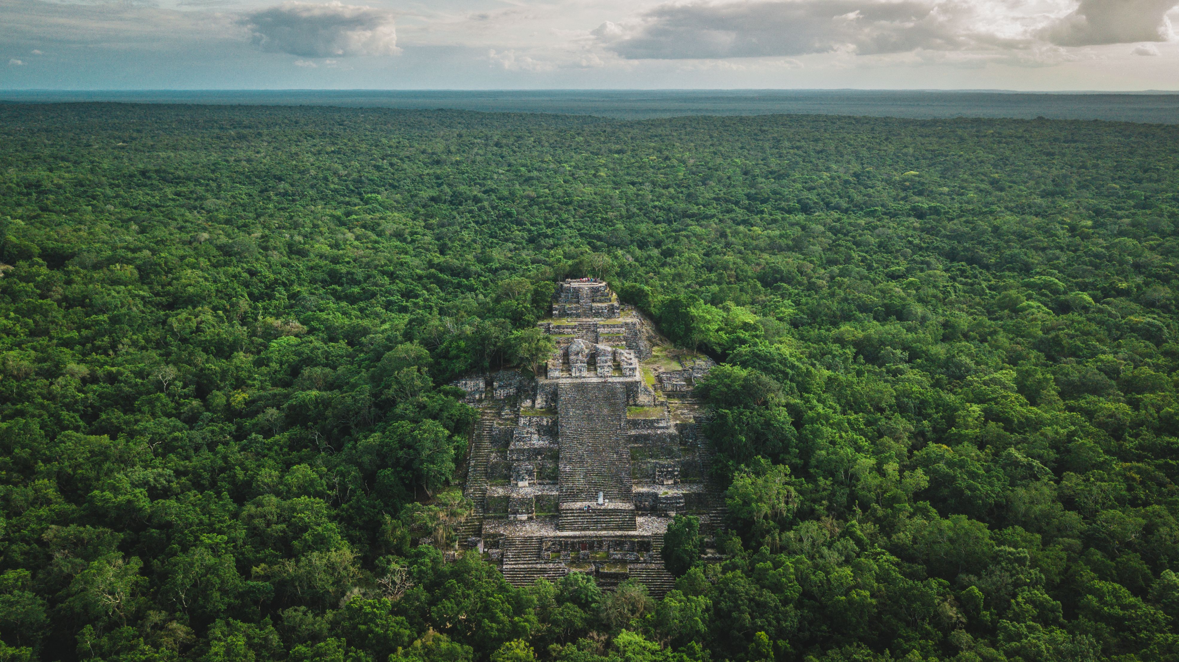
Aerial view of the pyramid, Calakmul, Campeche, Mexico. Ruins of the ancient Mayan city of Calakmul surrounded by the jungle | Image Credit: © Alfredo - stock.adobe.com
Airborne lidar survey systems consist of a laser scanner, an inertial measurement unit (IMU), and a global positioning system (GPS) that are attached to aircraft units like helicopters or airplanes. This method is used to create a point cloud containing the X, Y, and Z-coordinates of whatever subject is scanned (2). These techniques are often used to analyze large pieces of land, including Mayan settlements.
Architecture is a major indicator of wealth and status in ancient Mayan culture, with materials, size, and local distributions being key factors in identifying and inferring social, economic, and political relations between communities. The researchers examined the residential structures representing different wealth and status across several datasets. The researchers studied how viable the architecture can be for indicating wealth and status, regularities in size and distribution of vaulted structures in different settings, and patterns in spatial distribution of vaulted architecture as proxies for differences in wealth and status within different settlement regions.
The proposed method was applied to 11 lidar datasets (about 111,000 structures). One notable finding was that only 30% of the structures held vaulted architecture, which confirms that this type of structure was restricted to more wealthy people in Maya society. It was also revealed that house sizes play a factor in this as well. Larger, vaulted structures were built most frequently in urban and larger plaza areas, with these groups being distributed through periurban and rural areas at regular intervals. This suggests that elite groups were distributed through landscapes to manage as much of an area as possible, with the chances of administrative and ceremonial functions being involved being likely. As for non-elite residences, they were often well-defined due to a lack of structure clusters and were often found near other larger groups, inferring that they represent neighborhoods and/or districts held by the elite “houses” surrounding them.
The scientists’ architectural analysis highlighted the presences of elite features within Maya architecture, with the frequency of buildings with said features being enough to infer that elite Mayans often lived within the vicinity of less affluent peers. This could lead to new insights on how Maya communities were organized, and according to the scientists, the findings in this study “[highlight] the importance of top-down processes in the formation of Maya urban and rural landscapes in contrast to prevailing views” (1).
Reference
(1) Estrada-Belli, F.; Gilabert-Sansalvador, L.; Cahuto, M. A.; Šprajc, I.; Fernandez-Diaz, J. C. Architecture, wealth and status in Classic Maya urbanism revealed by airborne lidar mapping. J. Archaeol. Sci. 2023, 157, 105835. DOI: https://doi.org/10.1016/j.jas.2023.105835
(2) Airborne LiDAR. DELTALiDar 2017. www.deltalidar.com/en/Airborne-Lidar.aspx (accessed 2023-10-31)
Newsletter
Get essential updates on the latest spectroscopy technologies, regulatory standards, and best practices—subscribe today to Spectroscopy.


AI-Powered Fusion Model Improves Detection of Microplastics in the Atmosphere
July 17th 2025Researchers from Nanjing University of Information Science & Technology have introduced a breakthrough AI-enhanced multimodal strategy for real-time detection of polyamide microplastics contaminated with heavy metals.

High-Speed Immune Cell Identification Using New Advanced Raman BCARS Spectroscopy Technique
July 16th 2025Irish researchers have developed a lightning-fast, label-free spectroscopic imaging method capable of classifying immune cells in just 5 milliseconds. Their work with broadband coherent anti-Stokes Raman scattering (BCARS) pushes the boundaries of cellular analysis, potentially transforming diagnostics and flow cytometry.

AI-Powered Raman with CARS Offers Laser Imaging for Rapid Cervical Cancer Diagnosis
July 15th 2025Chinese researchers have developed a cutting-edge cervical cancer diagnostic model that combines spontaneous Raman spectroscopy, CARS imaging, and artificial intelligence to achieve 100% accuracy in distinguishing healthy and cancerous tissue.


Drone-Mounted Infrared Camera Sees Invisible Methane Leaks in Real Time
July 9th 2025Researchers in Scotland have developed a drone-mounted infrared imaging system that can detect and map methane gas leaks in real time from up to 13.6 meters away. The innovative approach combines laser spectroscopy with infrared imaging, offering a safer and more efficient tool for monitoring pipeline leaks and greenhouse gas emissions.

How Spectroscopy Drones Are Detecting Hidden Crop Threats in China’s Soybean Fields
July 8th 2025Researchers in Northeast China have demonstrated a new approach using drone-mounted multispectral imaging to monitor and predict soybean bacterial blight disease, offering a promising tool for early detection and yield protection.

